
This hike started at Wondabyne train station in the Brisbane Waters National Park. Wondabyne is basically a train stop on the Central Coast of New South Wales, 63 kilometres, (39 miles) or just over an hour north Sydney. In the 2021 census, its population was 3. Wondabyne station sits on Mullet Creek with its picturesque beauty, it is a quiet and idyllic spot.
Our group of eight’s destination was Kariong, a suburb also located on the NSW Central Coast which is 70 kilometres, (43 miles) north of Sydney. Our one way walk would take us to Girrakool and a crossing of Piles Creek on a suspension bridge and on to Monolith Rock and its two caves.
Hiking In Brisbane Waters National Park -Wondabyne To Kariong
- When: 04 October 2024
- Where: Brisbane Waters National Park. Starting at Wondabyne train station and finishing at Kariong where a bus would takeus to Gosford train station.
- Weather: Overcast in the morning but cleared and sunny by mid-morning to a warm Sydney Spring day with a low of 53.6 F (12C) and a high of 75.2 F (23 C) It felt warmer.
- Departure: From Wondabyne train station at 8:05 am and arrived Kariong bus stop at 2: 30 pm
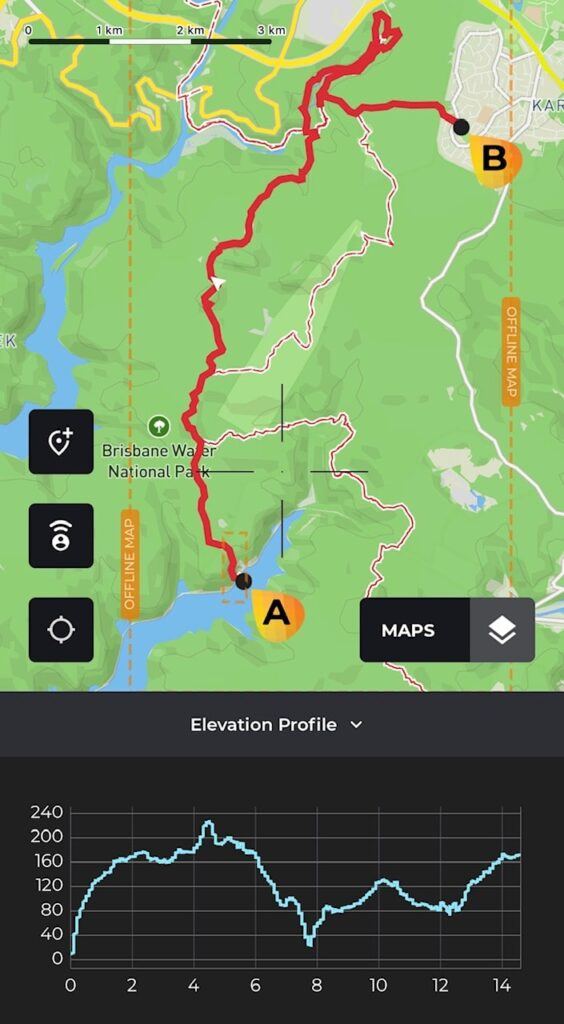
- Length: 9.07 miles, 14.7 km
- Elevation gain: 1788.06 ft, 545 m
- Duration: 6 hours 25 minutes, including breaks
The Start
There is no avoiding the short sharp 200 odd metre (660 ft) climb up from Wondabyne train station, which I refer to as “The Heart Starter” and a bit of a rude shock to the system first thing in the morning. Once up the top our path took us along the wide fire trail. The wild flowers were not in abundance as they had been on my last visit there a few weeks ago, which made me thankful that had seen them in full bloom.
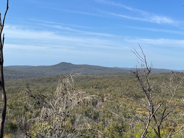
After just shy of an hour on the firetrail we exited onto The Great North Walk track in the direction of Girrakool which was to be our lunch spot. The track quickly narrowed down becoming quite dense in sections. Varied would be the best word to describe the track as it undulated with rocky ups and downs to suddenly open out to rock platforms that gifted us sweeping views of the dense bush of the Brisbane Waters National Park.
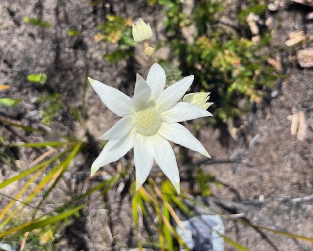
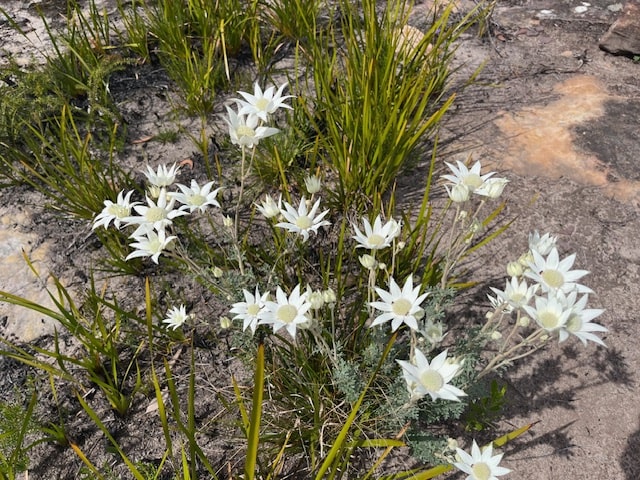
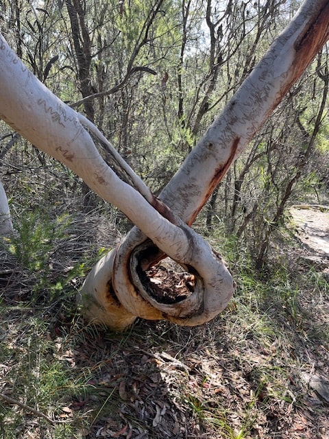
While the wild flowers were not as prolific as they had been three weeks ago, it appeared that white Flannel Flowers had taken their place. These flowers grow well after a fire has been through an area. The track continued to throw varied terrain our way as we were met with wet patches, rocks to navigate that once again opened into small rock platforms. The eucalypt forest gifted us some trees growing in their own dramatic twisted formation.
Phil Houghton Bridge
Eventually, the trail took us down into the gorge to Piles Creek, which was our morning tea destination. The creek can be crossed by the new metal suspension bridge which replaced the old bridge. Remnants of the old wooden bridge remain upstream. The bridge is named in honor of Phil Houghton who saved a woman drowning in the creek.
Girrakool Picnic Area
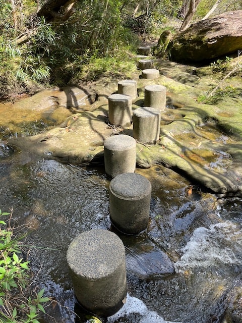
Our route saw us exit The Great Northern Walk track and onto the Piles Creek Loop track, which carried us up out of the gorge on to our lunch destination. This section seemed less rugged with the luxury of wooden steps in parts and concrete stepping stones conveniently placed over a section of Leask Creek to avoid wet feet. I also noticed that the spring wildflowers were greatly more abundant in this section of the trail.
Girrakool Picnic Area was an extremely civilised spot with flushing toilets, public barbeques with tables and bench seating, definitely not the norm when bushwalking. We accepted the comforts with enthusiasm enjoying our lunch.
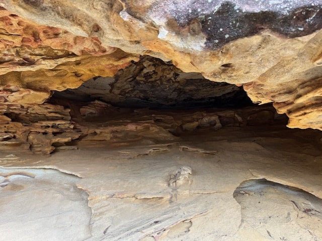
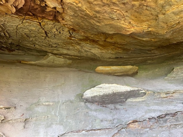
Monolith Cave
Our next section of the hike took us on to the Girrakool Loop Track where we made quick stops at Broula and Illoura Lookouts taking in the views into the gorge below. Monolith cave was our final destination before completing the hike to Kariong. This un-officially named cave, is an unusual sandstone rock formation with a cave at the front and another round the back. The caves are not deep nor large but provide great shelter to walkers who stop to admire their standstome walls.
The Final Leg
This section had us back onto The Great Northern Walk Track, where we continued for a short distance until turning off onto a smaller un-named and rather dense track which was to take us to Kariong. For some unknown reason the track just vanished and we were forced to bush bash for a short section until we met up with the continuation of the track to Kariong. That’s the Aussie bush for you.
My Final Thoughts
The variation of the tracks and contrasting scenery made this an interesting hike as we changed from rocky sections that required careful foot placement to open rock platforms, gifting us stunning vistas of the rugged bush. The cool serenity of Piles Creek contrasted the modern Girrakool picnic area while the morning abundance of white Flannel Flowers opposed the bright wildflowers in the afternoon. The most unusual sight was this crazy looped tree.
Happy Hiking!
If you have a question or a comment, please leave them below.