
This hike was in the Bungonia National Park which is 2 – 2.5 hours southwest of Sydney in the beautiful Southern Highlands region of New South Wales. I was a little nervous about this one as it was a Grade 5. Hikes in Australia are graded 1 – 6 with 6 being the most challenging. Years ago I regularly took on hikes like this, but not in the past few years. As I was really interested in the boulder field, plus having decided that it’s time to start challenging myself a little more, I committed to tackling this adventure.
Bungonia National Park Hike – The Bungonia Circuit
- When: 8 September 2024
- Where: Bungonia National Park.
- Weather: Overcast but clearing Southern Highlands spring day with a low of 44.6 F or 7 C and a high of 62.6 F or 17 C.
- Departure: Bungonia National Park car park at 08:40 am and arrived back at the car park at 2:37 pm
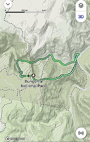
- Length: 5.41 miles or 8.7 km
- Elevation gain: 2041 ft or 622 m
- Duration: 6 hours , including breaks
The Start
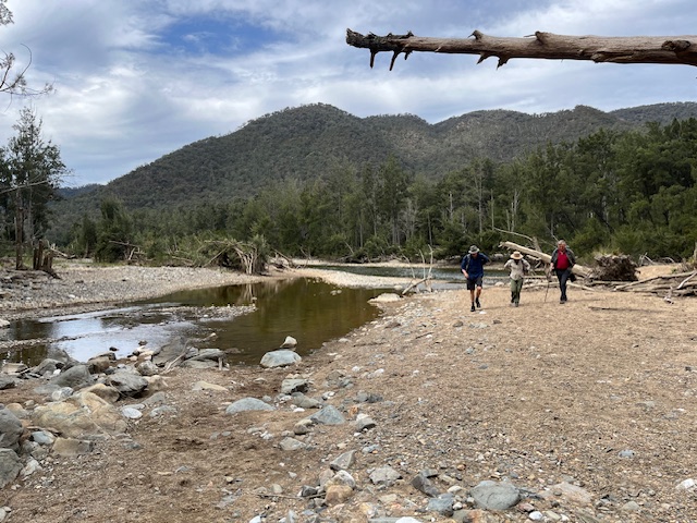
We were a rather large group of 20 and after a 2 hour drive met in the carpark of the Bungonia National Park. We headed off at 8:40 am and got straight into our descent, our destination for this section was the bottom of the gorge and the Bungonia Creek.
The red track down to the gorge was well defined but quite slippery underfoot due to the loose rocks, leaves and shale like cover. We criss crossed Bretons Creek and pretty much followed the creek down to where it joined the Bungonia Creek.
This is Wombat country and the track was littered with freshly laid wombat poo, with its distinctive square shape. After approximately 50 minutes and a 1300 ft (396 m) descent we reached the Bungonia Creek which we would follow for the majority of the walk. Onto our next destination; the much anticipated boulder field.
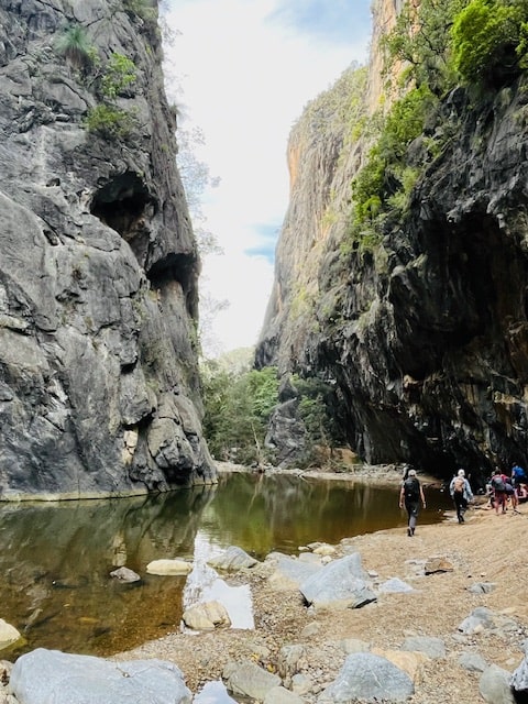
The Boulder Field
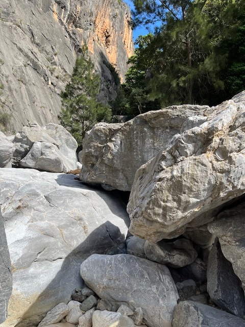
After about 15 minutes of hiking along the dry creek bed, with the sides of the gorge towering above us, we reached our anticipated boulder field. Here we would have to navigate the huge boulders made of smooth and slippery limestone. Luckily it was a clear day or the walk would have been cancelled. The boulders were slippery enough and didn’t need any water.
We navigated the boulders going under, over and around. We wedged ourselves between the massive rocks, using our arms, legs and butts to support ourselves as we eased our bodies safely down to a stable landing spot to then navigate our way over, around or under the next obstacle.
It was slow going and careful work as one slip could be catastrophic causing serious injury with the only way out by helicopter. In less than an hour we all safely made it to the end of the boulder field where we chose our spots to enjoy a well deserved morning tea.
Following The Bungonia Creek
The next section of the walk took us along the Bungonia Creek. We quickly crossed the creek, thanks to a well placed log and continued along the bank. The terrain was quite rocky and care had to be taken with our foot placements.
After 1 hour and 15 minutes we traversed back over to the other side of the creek, choosing well placed rocks as our stepping stones. Our destination was the confluence point of the Bungonia Creek and the Shoalhaven River – our lunch spot and a good opportunity to remove our boots, clean them out, removing the bits of uninvited debris that managed to find its way in, no I wasn’t wearing gaiters, and give our feet a cool soak in preparation for the steep climb out of the gorge.
The Climb Out
Just before 1:00 pm we started the steep climb out. Its sudden gradient hitting us in the face like a slap of cold air on a frosty day. We continued hiking along the ridge of the spur with sloping sides either side of us. Bring on the half way point where the track levelled out. My calves were screaming as they had really tightened up and were cramping, despite my mineral salts in my water. Note to self to up the ante with the salts.
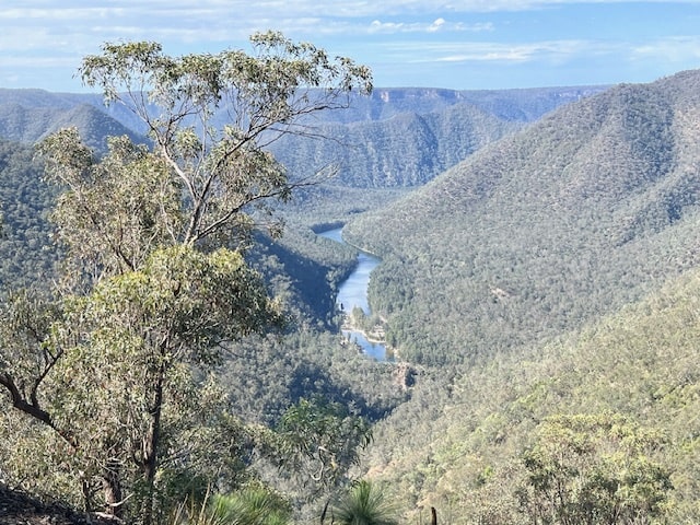
After about 40 minutes the track levelled out. Yay! This was the halfway mark of our ascent. The view of the Shoalhaven river below was spectacular and a pleasant distraction from the tough climb out.
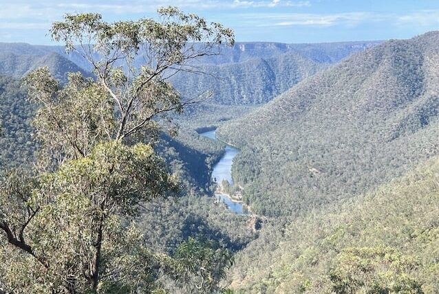
Mount Ayre Lookout
Our reward for our efforts was a stop at Mount Ayre Lookout. The view permitted us to see where we had hiked from, which always amazes me. The Bungonia Creek below looked perfect as it wove through the bush landscape. The ascent from the river was 1371 ft or 417 m, which isn’t huge as far as climbs go, but it certainly was a short and sharp climb. The walk to the carpark from the lookout was easy and by 2:37 pm we had completed our hike.
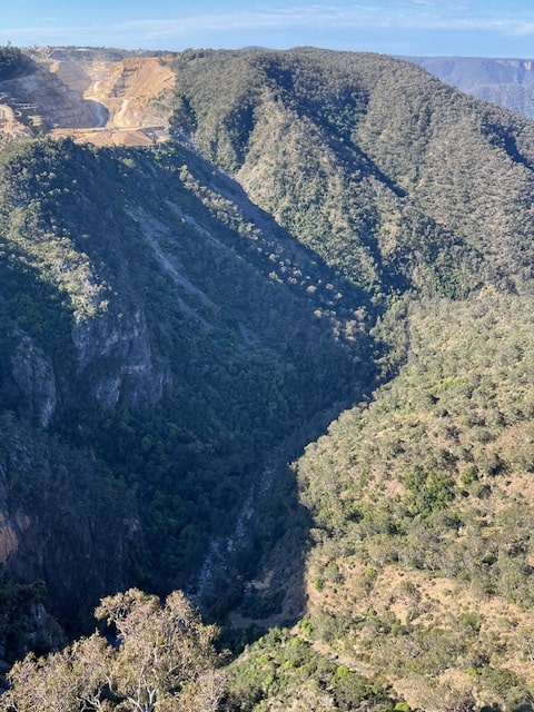
The Lookdown
Before heading home we made a quick stop at The Lookdown which is a lookout. From here we could see the boulder field that we had negotiated beneath us and in the distance The Marulan South limestone mine and works. This mine started operation in 1871 and its limestone was used to manufacture the tiles on the famous Sydney Opera House.
My Thoughts on The Bungonia Circuit
This truely was a memorable hike, all on track with a great variety of terrain. The highlight was the boulder field and the challenge it presented. The lowlight, my cramped calves that really made the climb out testing. But hey, I did it! Happy Hiking!
If you have any questions or comments to leave, I’d love to hear from you.