
This hike in the Kosciuszko National Park was a memorable adventure, covering two of the three peaks in the Ram’s Head Range. It was mostly off-track, offering stunning alpine views, challenging terrain, and a sense of true wilderness.
The Rams Head Range Hike Guide
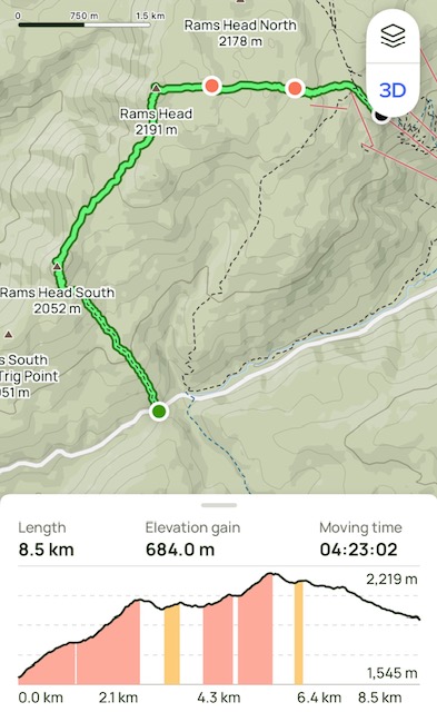
- When: 20 December 2024
- Where: Kosciusko National Park
- Weather: Clear and still summer’s day with an overnight low of 37.4F (3C) and a high of 84.2F (29C)
- Departure: From Dead Horse Gap Trail Head off Alpine Way
- Length: 5.28 miles, 8.5 km
- Elevation gain: 2244 ft, 684 m
- Duration: 4 hours 23 minutes moving time
The Start
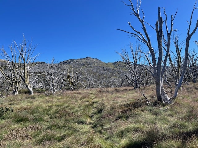
Three of us set off at 8:40 AM, beginning our journey on the Dead Horse Gap Track. The initial climb was steep, with a narrow path no more than 30 cm wide. We initially hikes through the snow gum forest, but as the vegetation changed to alpine bushes and grass, the track was difficult to follow, which added an extra layer of challenge to the hike, finding ourselves hiking through the alpine bushes. As a precaution we wore gaiters to give a level of protection from snakes.
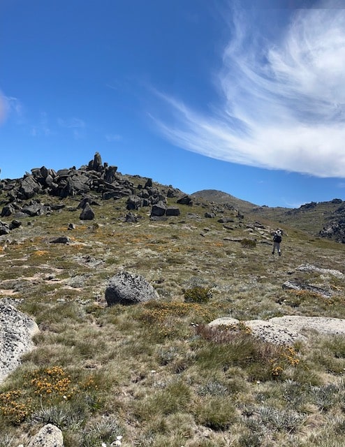
Ram’s Head Southerly Trig
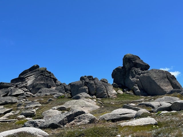
After about 30 minutes, the trail flattened slightly, leading us toward what we initially thought was Ram’s Head South. Instead, we found ourselves at the rocky outcrop of Ram’s Head Southerly Trig (2052 metres or 6732 feet). Many maps including All Trails have the unofficial trig marked as Rams Head South. Rams Head South stands at 1951 metres or 6400 feet and is south of the Southerly Trig that we reached.
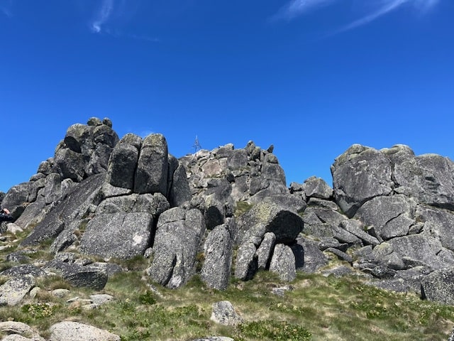
Reaching the Trig wasn’t straightforward. After attempting two routes clambering over the huge boulders, I decided to retrace my steps down to the base of the rocky outcrop and search for a more manageable path. Eventually, I discovered a shallow grassy gully of sorts, free of the massive, impassable boulders we had encountered earlier. This route led us to the summit of Ram’s Head Southerly Trig.
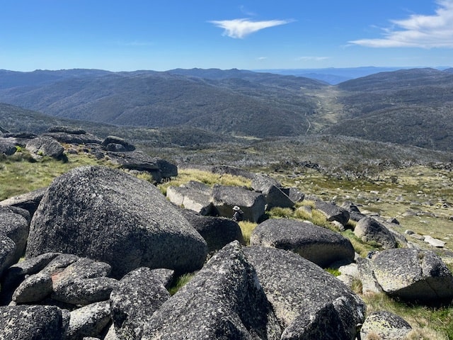
The views from the top were breathtaking—360-degree panoramas of the alpine wilderness. It was the perfect spot for a well-earned morning tea break.
The Route to Ram’s Head
From the Trig, we plotted our route to Ram’s Head. This section was entirely off-track, requiring careful navigation to ensure our path was both safe and manageable. Descending from Ram’s Head Southerly Trig, we crossed a grassy alpine gully before tackling the increasingly steep terrain leading to the next summit.
Reaching the peak of Ram’s Head at 2,191 meters or 7188 feet was a highlight of the day. Marked by a cross, the summit offered spectacular views, including a clear sight of Mount Kosciuszko in the distance. You can read about my hike up to the summit of Kosciuszko here. After capturing the obligatory photos, we began our descent toward the Kosciuszko Trail.
Trekking Toward the Kosciuszko Trail
Although we had hoped to continue to Ram’s Head North, time constraints forced us to save that peak for another day. Instead, we descended from Ram’s Head and made our way toward the Kosciuszko Trail, taking care to avoid marshy areas and watching out for snakes—again we were grateful for our gaiters.
The terrain was challenging, with thick alpine bushes and a landscape dotted with massive rocky outcrops. At times, it felt like walking on a moonscape. Eventually, the familiar sight of the Dead Horse Track junction came into view, signaling the end of the off-track portion of our hike.
From there, we followed the Kosciuszko Trail to the chairlift, which carried us down to Thredbo. We wrapped up the day with a well-deserved late lunch, recounting the day’s adventures.
My Final Thoughts
This mostly off-track hike through the Ram’s Head Range was an exhilarating experience. The weather was perfect, with clear blue skies highlighting the alpine flowers and rocky outcrops that defined the landscape. Tramping across unmarked terrain gave a sense of freedom that’s hard to replicate.
I’m already looking forward to returning to tackle the third peak and complete the Ram’s Head Range. If you’re after a challenging hike with spectacular views and a touch of adventure, this is one to add to your list. Happy hiking!
If you have any questions or comments, please leave them below.