

Today’s hike took me to the beautiful Blue Mountains National Park, located west of Sydney. Our group of 17 adventurers started near the quaint township of Leura, with the trailhead just off Mount Hay Road, which transitions to a dirt track. The journey was filled with breathtaking views, fascinating wildlife, and a bit of history.
Fortress Ridge Hike Guide
- When: 28 December 2024
- Where: Blue Mountains National Park
- Weather: Clear and still summer’s day with an overnight low of 53.6F (12C) and a high of 73.4F (23C)
- Departure: From Mount Hay Rd, Leura
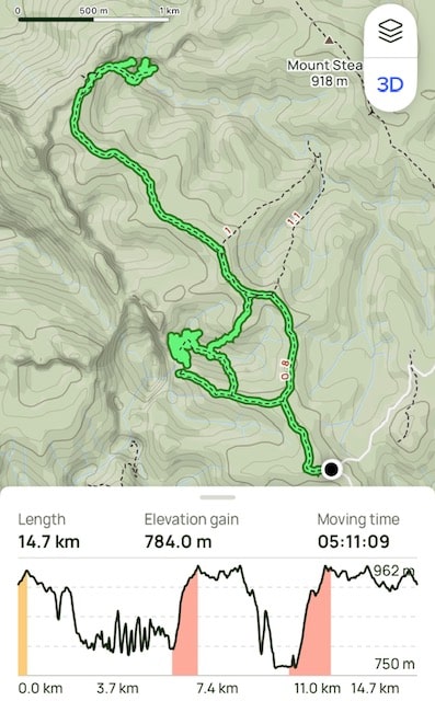
- Length: 9.13 miles, 14.7 km
- Elevation gain: 2572 ft, 784 m
- Duration: 5 hours 11 minutes moving time
Destination 1: Fortress Rock Lookout
The hike began on the Fortress Ridge Trail, a wide, stony fire trail with a gentle ascent. Not long into the walk, we spotted a rare and highly venomous Sydney Funnel-Web Spider right in the middle of the path. It’s unusual to encounter one on an open trail, so naturally, we paused for photos before continuing.
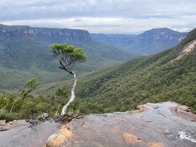
After roughly 700 meters (2,300 feet), the fire trail gave way to a narrow bush track. The route to Fortress Rock Lookout was what I like to call an “undulating descent.” Upon reaching the lookout, which is located at the end of a spur on the Fortress Ridge, we were rewarded with awe-inspiring views into the Grose Valley below. Towering sandstone cliffs and the lush green canopy stretched out before us, a sight that was nothing short of spectacular.
Destination 2: Dr Dark’s Cave
We retraced our steps to find the narrow track leading to Dr Dark’s Cave. The descent was steep and rocky, and though the distance was only 800 meters (2,625 feet), the tricky terrain and low rock overhangs made it feel much longer.

Dr Dark’s Cave is essentially a large rock overhang, but its history adds an intriguing layer to the hike. Dr. Eric Payten Dark (1889 – 1987) , a medical practitioner at Katoomba, and WWI veteran, discovered the cave in 1937. He and his family (wife Eleanor and sons Brian and Michael) used it as a retreat, leaving behind neatly stacked possessions like pots and cooking utensils near their makeshift stove which are still there today.
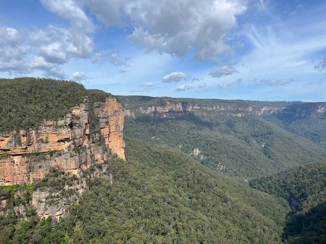
Some of us ventured beyond the cave to the edge of the headland. Carefully navigating low overhangs and staying mindful of the sheer drop, we gazed up at Fortress Rock Lookout, where we had stood earlier. The perspective from below made us feel as though we were nestled within the gorge itself.
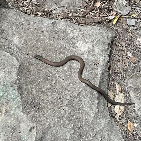
On our way back to the cave for morning tea, we crossed paths with a juvenile Eastern Brown Snake—the second most venomous land snake in the world. A thrilling encounter, though not one we lingered over!
The Route to Fortress Ridge Track
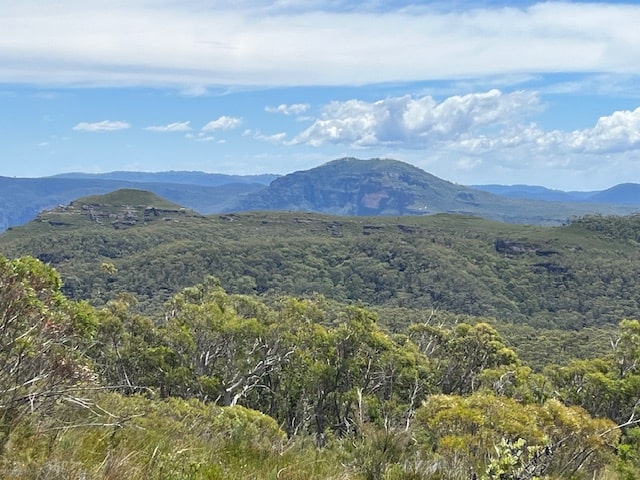
After a quick break, we initially backtracked but soon took a steep, off-track section to ascend to the ridge and after a short bush-bash we joined the Fortress Ridge Track. This took about 30 minutes and once on top, we were greeted with panoramic views of Flat Top, Mount Hay, Locheys Pylon, Mount Banks and Govetts Creek deep in the valley below.
Destination 3: Fortress Falls
Walking along the ridge offered stunning views of the National Park, with white flannel flowers still in bloom. To reach Fortress Creek Falls, we began our descent—but took a wrong turn down a track that became impassable. After backtracking and regaining the proper path, we tackled the extremely steep and technical descent. Every step required caution, as getting injured here would have been a serious challenge.
Arriving at the falls was worth the effort. A group of canyoners was already there, and the sight of water cascading over the cliff edge was mesmerizing. The small pools were perfect for cooling our feet, and I made sure to wet my cap and hiking towel to stay cool for the steep climb back out.
The Final Stretch
The climb out, though steep, wasn’t as difficult as I’d expected. Descending had been far more challenging! Once back on the ridge, we retraced part of our route before taking a fork in the trail that led us back to the fire trail and our waiting cars.
My Final Thoughts
This hike was a hidden gem, offering a mix of scenic views, historical intrigue, and a bit of adventure. The variety of trails, including a short off-track section, made for an exciting challenge. Spotting two of Australia’s deadliest creatures along the way added an unforgettable twist.
Compared to my previous week hiking in the Snowy Mountains, this experience in the Blue Mountains felt like a completely different world—a reminder of the incredible diversity Australia has to offer for hikers. Happy Hiking!
If you’ve hiked this trail and have any questions, I’d love to hear from you.