
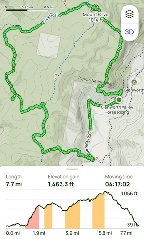
This week’s hike took us to Popran National Park on the Central Coast of New South Wales. A lesser-known spot, Popran is a relatively small park at 3,970 hectares (9,800 acres) and is about 95 kilometers (59 miles) north of Sydney. Named after Popran Creek, which flows roughly 24 km or 15 miles, southward from Central Mangrove to Mangrove Creek, this park offers unique bushland trails and the tranquility of Emerald Pool and Mount Olive—no coastal views, but plenty to enjoy.
Given the forecasted high temperatures in the high 20s C , our group decided to start an hour earlier than planned—a wise call!
NSW Central Coast Hikes- Popran National Park
- When: 6 November 2024
- Where: Glenworth Valley Riding School and Popran National Park on the NSW Central Coast.
- Weather: Started overcast but cleared, with a low of 60.8 F (16C) and a high of 75.2 F (24 C) with a feels like warning of 84.2 F (29 C).
- Departure: Starting and finishing at Glenworth Valley Riding School.
- Length: 7.7 miles, 12.39 Km
- Elevation gain: 1463 ft, 446 M
- Duration: 5 hours 16 minutes, including breaks, moving time of 4 hours 17 minutes.
The Start
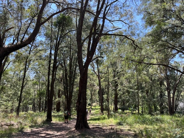
Our group of 11 began our hike at 8:30 a.m. from Glenworth Valley Riding School. Since this is private property, you’ll need permission if you plan to start your hike here. From the riding school, we trekked along Cooks Rd, a dirt road, before turning onto a bush track that began our gentle climb. I noticed the ground was scattered with cicada shells and got the inkling that we could possibly hear their singing today, a typical feature of the Aussie bush in summer.
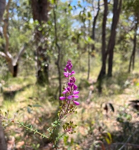
About an hour into our hike, we reached Mount Olive Trail, which eventually led us onto the Hominy Creek Firetrail. Following this trail brought us to our morning tea spot at Emerald Pool. Along the way we still found late blooming wildflowers but they were in in abundance as they previously had been.
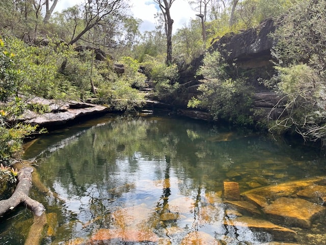
Morning Tea at Emerald Pool
By 10:30 a.m., we were settled at the beautiful rock pool, which is part of Hominy Creek. As we enjoyed our break, we spotted a crayfish in the pool—a nice surprise! With the day warming up, I decided to wet my cap and hiking towel to cool down, wrapping it around my neck for the next section of the hike.
Lunch Destination: Mount Olive
Continuing on, we hiked along Hominy Creek Trail, passing through a lush Casuarina forest known as Donovan’s Forest (though I’m still not sure who Donovan is!). This area is a known habitat for the rarer Glossy Black Cockatoos (they love casuarinas), though we weren’t lucky enough to spot any this time.
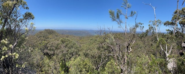
We then followed the 248 Trail, accompanied by the full chorus of cicadas, reaching Mount Olive around 12:10 p.m. At 1,014 feet or 309 metres, the lookout here provided peaceful views over the creek and surrounding bushland.
The Descent
Our descent began on Mailman’s Walking Track, which was fairly smooth—until I had a painful encounter with some red bull ants. Their bites were sharp, but luckily I had my damp towel on hand to help with the sting. By 1:45 p.m., we were back at our cars, ready for the drive home. Learn all you need to know about bull ants here.
My Final Thoughts
This easy grade 3 hike was an unusual one for an Aussie trail, as we began with a climb and ended with a descent—usually, it’s the opposite, starting down and finishing with an uphill push. The earlier start time was a smart move as the day got quite warm. Despite the ant bites, I enjoyed the walk and the sounds of summer cicadas—a classic Aussie touch. Happy Hiking!
If you have walked in this are or have any questions, please leave your comments below.