
Recently, I was invited on a reccie (short for reconnaissance) walk by a fellow bushwalking club member. The goal? To explore the feasibility of leading this off-track hike as an official club walk. I was keen to join—especially since it meant venturing off the beaten path around Mount Westmacott in Heathcote National Park, just south of Sydney.
There were four of us on this exploratory adventure, and we met at Waterfall Station, the starting point for our hike.
I’d actually done a similar route a few weeks earlier—but that one stuck to the main trails. You can check out that hike [here].
Mount Westmacott Hike Details
- When: 09 May 2025
- Where: Heathcote National Park
- Weather: Slight chance of rain in the afternoon on a mild autumn day with a low of 55.4°F (13°C) and a high of 69.8°F (21°C)
- Departure: From Waterfall train station, finishing at Waterfall train station.
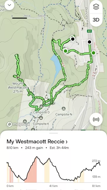
- Length: 5.03 miles, 8.1 km
- Elevation gain: 797 ft, 243 m
- Duration: 3 hours 44 minutes moving time.
The Start of the Hike
We began our walk from Waterfall Station, following the Princes Highway before turning right onto Bundarra Street. From there, we connected with the Coutts Camp Track, which leads to the local Scout camp.
We passed a couple of school groups using the camp—some of the kids looked like they were struggling under massive packs. Maybe they could have used a read of my post on [how to pack for a hike]!
The track descended gently toward Heathcote Creek. With the recent rain, it was a bit muddy and slippery in places, so we took it slow and steady.
After passing through the campgrounds, we followed a short stretch of fire trail before branching off onto the Mt Westmacott Track. The climb began straight away, but the final section to the summit only required a bit of light scrambling—nothing too difficult.

Morning Tea at Mount Westmacott
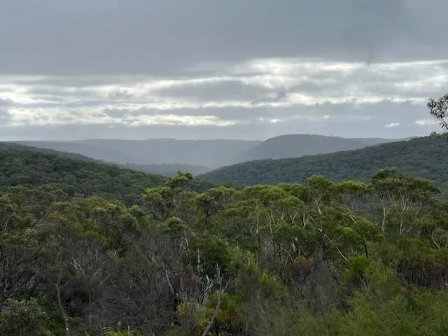
We reached the top of Mount Westmacott and paused to enjoy morning tea with sweeping views of Heathcote National Park. It’s a peaceful spot—perfect for a break and a bit of route planning.
We spread out the map and discussed the plan for our off-track section. The idea was to follow the ridgeline to avoid the steeper drop-offs on either side. Using a traditional map and compass (as outlined in my post on [navigating with a map and compass]), we plotted our course.
Off-Track Navigation: 1.5 km of Bush-Bashing
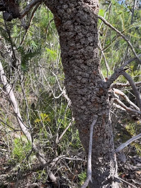
The off-track section was only 1.5 km (just under 1 mile) in length, but it was dense bush the entire way. We anticipated slow progress—and we weren’t wrong.
At first, the bush wasn’t too thick, but after an hour, we’d only covered about 500 metres (0.3 miles). We paused to reassess.
Decision Time
It was midday. At our current pace, we estimated we’d reach the Bullawarring Track around 2:00 pm if we managed to keep up the same pace,. With sunset expected around 5:00 pm, continuing forward, our first option, felt risky as we’d still have to hike out of the park.
We studies the map again. Our second option was to cut east and try to reach a nearby fire trail. It was a shorter distance, but the terrain looked steeper and the bush just as dense.
Option three: retrace our steps. With our map, compass, and navigation apps tracking our route, this felt like the safest choice.
Though it was a bit disappointing, we all agreed—safety always comes first.
The Return and a New Plan
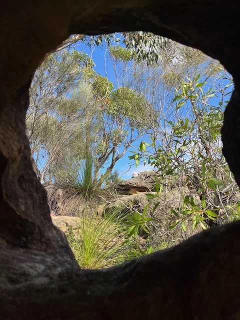
After an hour of bush-bashing back the way we came, we rejoined the main track and made our way to the fire trail. We stopped for lunch on a rocky platform we’d passed earlier that morning—still a beautiful spot, even with a light drizzle starting to fall.
After lunch, we agreed to take a different return route via Lake Toolooma. One of our group knew of a trail leading off the fire trail that would take us up toward the suburban streets and back to the station.
Eventually, we arrived back at Waterfall Station, grabbed a coffee, and had a great debrief about the hike.
My Final Thoughts
This off-track reccie hike around Mount Westmacott was a great learning experience. It reminded me just how important it is to remain flexible, especially when navigating unknown or challenging terrain.
Sure, we didn’t reach Bullawarring Track like we planned—but we made the right call. When it comes to hiking in remote or off-track areas, good decision-making can be the most important skill of all. And no, the hike won’t kame it onto the club program.
Have you ever had to turn back on a hike or change your route mid-way? I’d love to hear your story—drop it in the comments belo.