
So, I just wrapped up the last hike of the “Wondabyne Wanderings” series, a fantastic lineup of 12 NSW Central Coast Hikes our leader organized over the winter and spring. I managed to join a handful of them, and I’m glad I did!
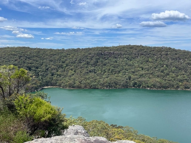
Our adventure took place in the stunning Brisbane Waters National Park, located about 63 kilometers (or 39 miles) north of Sydney, making it an easy getaway from the city. The hike would see us tackle varied terrains, not only taking us deep into the bush but also gift us spectactuler views over the Brisbane Waters.
You can read about my previous Wondabyne hike here.
The Hike from Wondabyne to Woy Woy
- When: 25 October 2024
- Where: Brisbane Waters National Park. Starting at Wondabyne train station and finishing at Woy Woy train station.
- Weather: Sunny spring day with no rain forcast with a low of 53.6 F (12C) and a high of 69.8 F (21 C) It felt warmer.
- Departure: From Wondabyne train station at 8:05 am and arrived Woy Woy train station at 4:30 pm
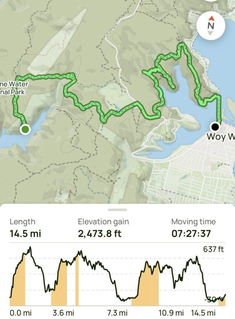
- Length: 14.51 miles, 23.35 km
- Elevation gain: 2474 ft, 754 m
- Duration: 8 hours 25 minutes, including breaks, moving time of 7 hours 27 minutes.
The Start
Like clockwork, we launched into the mandatory ten minute “Heart Starter” – a 180 m or 589 ft ascent from the station to the fire trail leading into the park. After approximately 20 minutes we turned off the Rifle Range Firetrail onto the narrow and muddy track, (a little slippery from the rain the night before) that led us on a descent over Myron Brook onto our morning tea destination of Kariong Brook Falls.
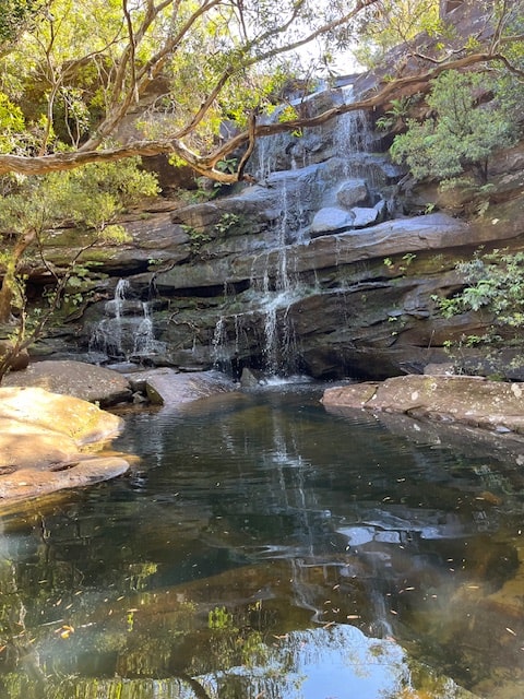
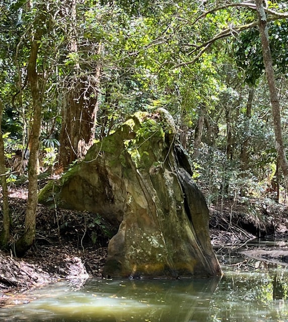
Morning Tea at Kariong Brook Falls
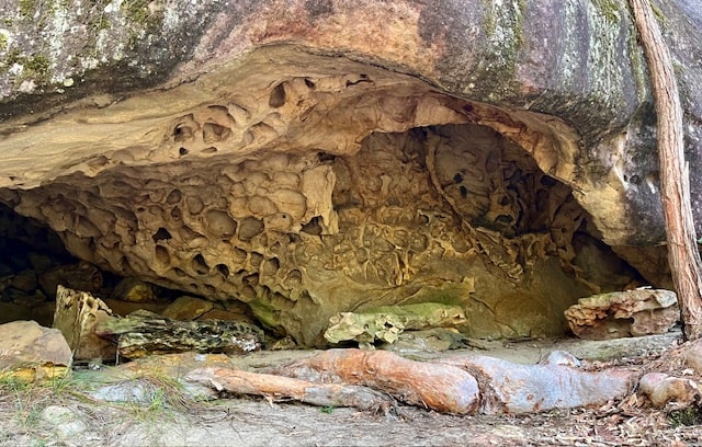
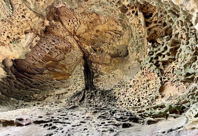
After about an hour and a half of hiking, we were enjoying a well deserved morning tea break at the picturesque Kariong Brook Falls. At the base of the falls is a small pool, perfect for a summer dip. The falls are surrounded by sandstone cliffs, overhangs and forest, giving the feeling of a private and secluded spot. Huge sandstone boulders that were once part of the overhang sat at the sides of the enclave, adding a dramatic touch.
Onward to Lunch at Spion Kop
We immediately tackled the short climb out from the falls, following Tommos Loop to Tunnel Track, which led us to Woy Woy Rd. A ten minute road walk, not my favourite, led us to Woy Woy Bay Trail. Luckily, the low tide gave us the opportunity to walk along the foreshore littered with oyster shells and mussels.
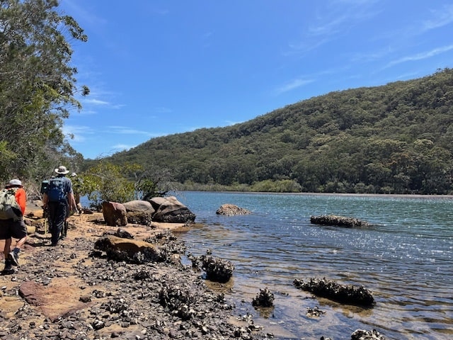
Once we passed the mangroves we strapped on our gaiters ready to commence the off track section, with the goal of crossing Scotts Creek and passing Scull Rock. We overshot the creek and had to back track to find the crossing point passing Skull Rock, which bore no resemblance to a skull!
We tackled some serious bush bashing up Spion Kop Ridge, eventually reaching our lunch stop. By 1:30 pm, we were happily perched with spectacular views over Woy Woy Bay and out to the Pacific Ocean. What a lunch spot!
The name Spion Kop (Afrikaans for “Spy Head”) was allegedly named after a famous Boer War battle site in the northern Natal Province – the hill, when viewed from a distance, is believed to bear a close resemblance to its South African counterpart.

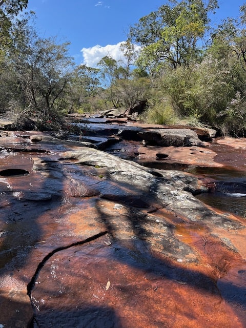
Hike to Waterfall Creek
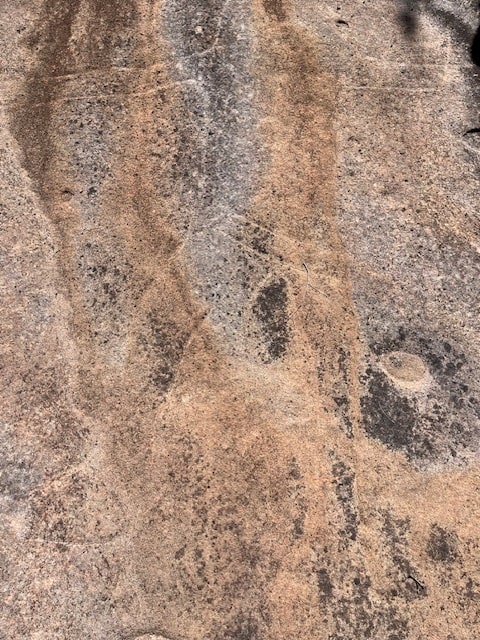
The track to Waterfall Creek treated us with more views of the Brisbane Waters, many unusual sandstone rock formations and overhangs and beautifully twisted Red Gum trees.. The creek featured a series of small rock pools that led to the small falls. The creek became part of our track which led us to some fine examples of Aboriginal rock carvings.
The Finish
Crossing the creek and our track led us to Koolewong Ridge Track, where we walked along the top of the ridge making our way down to the pathway along the forshore. Finally, we crossed over the overhead footbridge along Brisbane Water Drive, ending our trek at Woy Woy train station.
My Final Thoughts
This hike offered it all! -A mix of terrain – fire trail, tracks, bush bashings and creek crossings. Paired with spectactular views over Brisbane Water, and sections of bush with an abundance of unusual sandstone rock formations and twisted trees. Of all the Wondabyne walks, this one took the cake!
If you’ve hiked in this beautiful part of the world or have any questions about my adventure, feel free to drop a comment below! Happy hiking!