
Sydney is a city where nature is never too far away, and this urban bushwalk from Waverton to Chatswood proves just that. Starting in the charming, leafy suburb of Waverton, just 4 km north of Sydney’s Central Business District and finishing at Chatswood, 10 km further north, this walk offers a unique blend of bushland trails and suburban streets.
While road walking was inevitable given the proximity to the city, it was balanced by stretches through scenic reserves and lush, tree-lined streets. Our plan was to follow a section of the Great North Walk in Ku-ring-gai Chase National Park before making our way back to Chatswood. However, the hike didn’t go quite as planned, thanks to an unexpected track closure!
My Urban Hike from Waverton To Chatswood
- When: 23 January 2025
- Where: Lower North Shore of Sydney
- Weather: Clear and mild summer’s day with a low of 66°F (19°C) and a high of 77°F (25°C)
- Departure: From Waverton train station
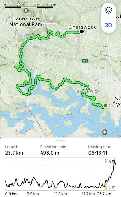
- Length: 14.72 miles, 23.7 km
- Elevation gain: 11617 ft, 493 m
- Duration: 6 hours 13 mintes moving time
Setting Off: Waverton to Gore Cove
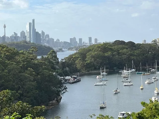
Our journey kicked off from Waverton Train Station, following Bay Road towards the water. It wasn’t long before we reached Sugarworks Reserve, a scenic spot along the foreshore of Oyster Cove. The track led us through Oyster Cove and Badangi Reserves before merging onto the Millars Road Track.
After a short stretch of road walking, we picked up the Gore Cove Track, which hugs the shoreline and winds into Milray Reserve. This section was a great introduction to the natural beauty hidden within the suburbs, with water views and shaded bushland paths.
As we walked through the leafy streets of Greenwich, we admired the mix of architectural styles—modern homes alongside beautifully preserved workmen’s cottages dating back to 1867.
A Track Closure Surprise
Our plan was to head towards Gore Creek Reserve, where the creek flows from the Lane Cove River. But upon arriving, we were met with a Track Closed sign, warning of an impassable section 400 meters ahead.
Curiosity got the better of us, and we decided to check it out anyway only to find heavy machinery and major works blocking the way. With no choice but to turn back, we took a lengthy detour via local streets to rejoin our intended route.
The Dreaded Road Walk
I’ll admit it, road walking isn’t my favourite, you can read about my hiking experience here. But sometimes, it’s unavoidable, and we found ourselves making our way along River Road, a busy street with traffic rushing past.
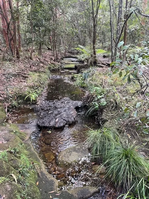
Fortunately, we soon escaped the urban sprawl and entered Warraroon Reserve, following the Tambourine Creek Track. Walking through the quiet bushland alongside the creek was a welcome change of pace.
A Well-Earned Break
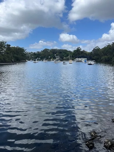
As we continued along the Tambourine Bay foreshore, we reached Burns Bay Reserve, an ideal spot for a morning tea break. With beautiful water views and a peaceful atmosphere, it was the perfect place to rest and recharge.
Refreshed, we pushed on through Linley Point Reserve before crossing the Lane Cove River via Burns Bay Road.
Joining the Great North Walk
Our next goal was to hit a section of the famous Great North Walk, a 260 km track stretching from Sydney to Newcastle. We found our way to Saint Malo Reserve, where a sign confirmed we were finally on track.
While parts of the trail passed through suburban streets, it wasn’t long before we reached Boronia Park, our designated lunch spot. Sitting under the trees, we enjoyed the break before diving into the next leg of our adventure.
Immersed in Nature
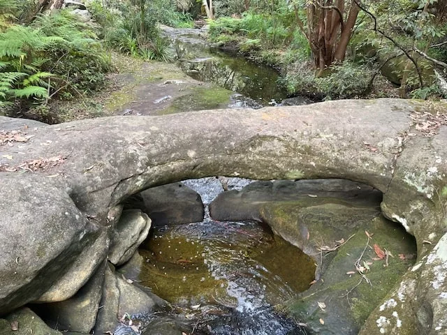
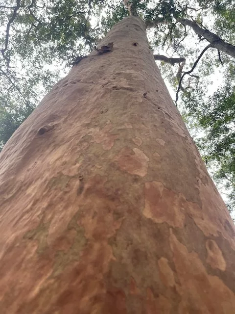
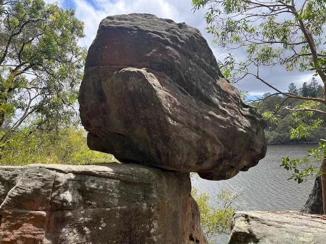
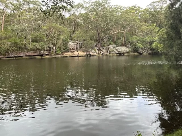
After lunch, the Great North Walk guided us along the meandering shoreline of Lane Cove River. This was easily the highlight of the walk, passing through mangrove swamps, sandstone rock formations, and eucalypt bush. The diversity of the landscape made it feel like a true escape from the city.
We followed the trail past Sugarloaf Hill and entered Lane Cove National Park. From there, the track led us through Magdala Park and across the river via a scenic bridge.
The Final Stretch
Crossing Epping Road, we ventured into Mowbray Park before taking the Upper Track and eventually switching onto the River to Rail Track. This trail hugs the Lane Cove River and was a peaceful end to our bushwalking experience.
The route then veered east, taking us through what used to be Chatswood Golf Course, now a development site. A short walk later, we arrived at Ferndale Walking Track, which follows the pretty Swains Creek. It was incredible to see such a serene bushland area nestled so close to the bustling city.
Soon, the familiar sounds of traffic signaled our arrival in Chatswood, where we wrapped up our journey and jumped on a train home.
My Final Thoughts
Despite the unexpected track closure and the stretches of road walking, this urban bushwalk was an enjoyable way to explore parts of Sydney I’d never seen before. The combination of bushland trails and suburban streets made for a diverse and rewarding experience. Happy hiking!
Have you done an urban bushwalk like this in your city? I’d love to hear about it in the comments!